GIS Software in 3D Mapping and Visualization theme
Products offering 3D mapping capabilities, enabling users to visualize data in three dimensions for enhanced analysis and presentation.
Updated July 05, 2026
Products that define this theme
A representative set of GIS Software products that exemplify 3D Mapping and Visualization, curated as a starting point for finding similar software.
Selected from G2's verified user reviews and ratings, then matched to this theme for relevance.
How Did G2 Choose These 3D Mapping and Visualization Products?
The 2 products shown represent a defining sample for the "3D Mapping and Visualization" theme within GIS Software on G2 — not an exhaustive list. They are a curated starting point for discovering similar software.
- Sourced from products with verified G2 user reviews and ratings.
- Matched to this theme based on each product's described capabilities and fit, ordered by relevance.
- Rankings and inclusion are unbiased and are not influenced by vendor payment.
Refreshed weekly. Last updated: July 05, 2026.

Maptitude is the best mapping software and GIS, on both desktop and online/SaaS/Cloud, to: • Optimize sales territories, vehicle routes, and site locations • Visualize, analyze, and present...

Octave Imagine is an all‑in‑one geospatial software platform designed to help users understand and work with complex imagery, maps, and 3D data without needing multiple separate tools. While many...
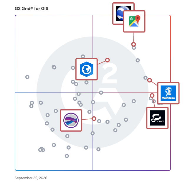
G2 Grid® for this theme