AI-Generated Results
Finding matches…
SKAND is a cloud-based platform that aims to democratise spatial data by providing a user-friendly interface to manage big data challenges and visualise complex spatial data sets. The web-app enables users to analyse, mark up and share spatial data with controlled access permissions.
Not seeing what you're looking for?
Dive deeper into "Gigs" on G2 AI

Koordinates is a geospatial data management platform inspired by cracking GIS data out of vendor silos. You can host, manage, share, publish, access, and build apps, alongside tens of thousands of others.

Precisely Demographics is a robust collection of demographic, geodemographic, and consumer context data designed to help you understand people and the places where they live, work, and do business.
These datasets offer you information for over 140 countries and territories worldwide, and empower you to conduct your analysis at the scale you need.
Precisely Demographics allows you to visualize population counts and characteristics at a nationwide, statewide, census-block, or lifestyle group level, and anticipate and plan for future trends with demographic estimates and projections.

SoftTech offers a comprehensive suite of geospatial services, including base map creation, DGPS surveying, field surveying, drone and LiDAR surveys, and enterprise GIS platform development, along with customized web GIS and mobile applications.

FSQ Spatial Desktop unleashes Kepler.gl from browser limitations by pairing its proven visualization excellence with native DuckDB on the desktop. GIS professionals who appreciated Kepler.gl’s capabilities but found it “gets limited fast” can now leverage the same GPU-accelerated visualization engine without WebAssembly constraints, browser memory limitations, or cloud dependencies. By combining Kepler.gl’s real-time rendering of millions of data points with native DuckDB’s sub-second spatial queries on multi-gigabyte datasets, professionals can perform complex spatial analysis and create compelling visualizations using familiar interfaces while maintaining complete control over their data. Built on the open-source SQLRooms framework, the platform enables community-driven extensibility through custom plugins while delivering the full computational power of desktop computing for performance-critical and visualization-intensive scenarios that browser-based tools simply cannot handle.

For the BI analyst, FSQ Spatial Workbench provides a streamlined path from business data to spatial insights through a familiar SQL-first interface. Analysts can load their business data into our pre-provisioned MotherDuck instances, perform spatial analysis through SQL queries with inline map visualizations, and seamlessly transition from exploratory analysis in SQL workbooks to creating publication-ready interactive Kepler.gl maps and dashboards.

LorikGISTools is a comprehensive geoprocessing toolbox designed to enhance and optimize geographic data from various sources. By integrating vector databases, georeferenced images, and digital terrain models, it enables users to identify, modify, and create data layers efficiently. The software supports a wide range of GIS file formats, including Shape, MIF/MID, E00, and KML, ensuring seamless data import and adaptation to the georeferencing of the workspace, even if original coordinates and structures differ.
Key Features and Functionality:
- Layer Import: Supports simultaneous import of multiple GIS file formats, adapting them to the workspace's georeferencing.
- Processing Tools: Offers specialized tools for polygons, polylines, points, and digital terrain models, facilitating tasks such as creating centerlines of polygons, identifying unconnected curve ends, and generalizing networks by identifying detours.
- Relief Representation: Integrates digital terrain models to automatically create smoothed contour lines and generate relief images in luminosity (shading) or altitude (color range) modes.
- Data Optimization: Provides tools for surface aggregation, allowing users to aggregate and simplify sets of polygons using tolerance parameters.
Primary Value and User Solutions:
LorikGISTools addresses the need for efficient and precise geoprocessing in GIS workflows. By offering a versatile suite of tools compatible with various data formats, it streamlines the process of data enrichment and optimization. Users can perform on-the-fly testing to adjust parameters, ensuring accurate results before creating new layers or exporting data. This capability enhances productivity and accuracy in cartographic production, making it an invaluable asset for professionals in the field.

Harness the Power of Persistent Monitoring With ENVI® Inform to Enhance Critical Decision Making.

ENVI® Discover empowers your entire organization with seamless access to all geospatial, non-spatial, and asset related data.

ENVI® Edge integrates real-time video with AI-powered alerts so tactical teams can streamline workflows and make mission-critical decisions with confidence.

Use ENVI® Geospatial Analysis Software to Extract Timely, Reliable, and Accurate Information From Geospatial Data.



The leading infrastructure mapping as a service provider. Inframappa onboards and serves all your physical assets information corrected and enriched to all your users and contractors in 2D/3D linked to a full fledged digital planroom with embedded IoT live sensors representation, Augmented Reality (AR) and virtual Reality (VR) Apps and hundreds of integrations. You do nothing, we get your product up and running and fully onboarded in a few weeks, no initial pay!

ProPaving is a satellite parking lot measurement tool built for paving contractors. Using high-resolution aerial imagery, contractors can measure parking lots remotely in minutes instead of spending hours walking job sites. ProPaving helps paving companies create accurate bids faster, win more jobs, and reduce wasted site visits. Priced at $49/seat/month.

ConnectServices is a comprehensive, collaborative, and intuitive WebGIS platform designed to empower users across various sectors to effectively manage and optimize their infrastructure data. By integrating advanced Geographic Information System (GIS) tools with an AI assistant named Connie, ConnectServices simplifies the storage, visualization, analysis, sharing, and utilization of infrastructure data, regardless of the user's technical expertise.
Key Features and Functionality:
- Multi-Source Data Integration: Supports various data formats, including FttH, FttX, electricity, gas, IoT, and EV charging stations, ensuring seamless integration of diverse infrastructure data.
- Collaborative Project Management: Facilitates teamwork with features like user roles, permissions, and version control, enhancing project coordination and data integrity.
- Interactive Mapping and Visualization: Offers dynamic map displays and synoptic views for intuitive data interpretation and decision-making.
- Field Intervention Planning and Tracking: Enables efficient scheduling and monitoring of on-site operations, improving fieldwork management.
- Statistical Analysis and Reporting: Provides dashboards and customizable reports with key performance indicators to support informed decision-making.
- AI Integration with Connie: Assists users in exploring data and obtaining personalized statistics, enhancing analytical capabilities.
Primary Value and User Solutions:
ConnectServices addresses the complexities associated with traditional GIS solutions by offering a user-friendly, web-based platform that requires no specialized GIS expertise. It centralizes data management, promotes real-time collaboration, and ensures data accessibility across devices. By streamlining infrastructure data handling, ConnectServices enables organizations to make informed decisions, optimize operations, and maintain resilient infrastructures, all while keeping costs predictable and manageable.

The GEORIZON Tile Server is a high-performance OGC raster tile server designed to publish and stream large imagery datasets for GIS platforms, web mapping applications, and digital twin environments. The platform enables organizations to efficiently serve aerial imagery, orthophotos, satellite imagery, and mobile mapping imagery through scalable web services.
Built for performance and reliability, GEORIZON delivers imagery through OGC standards such as WMS and WMTS, as well as modern web tile protocols including XYZ tiles and REST APIs. These services allow imagery to be easily integrated with popular GIS software such as ArcGIS, QGIS, and web mapping frameworks.
The platform is specifically designed for organizations managing large geospatial imagery collections, including national aerial surveys, infrastructure inspection imagery, corridor mapping projects, and mobile mapping datasets. Advanced tile caching and optimized data streaming ensure fast map rendering and smooth navigation even when working with massive datasets.
GEORIZON provides a vendor-independent imagery hosting platform, enabling organizations to publish raster imagery from multiple sensors and mapping providers through a single system. This prevents vendor lock-in and ensures long-term interoperability with existing geospatial workflows.
The tile server integrates seamlessly with GIS, CAD, and asset management systems via standard geospatial services and APIs. It can be deployed in both cloud and on-premise environments, making it suitable for organizations with strict data governance or high-performance infrastructure requirements.
As a modern alternative to traditional imagery servers, GEORIZON provides a scalable solution for organizations looking to replace legacy systems such as ArcGIS Image Server or ERDAS Apollo, while enabling faster imagery delivery for GIS platforms, digital twins, and web-based geospatial applications.

Geomapping automatically reads your articles, extracts every location mentioned, finds precise coordinates, and builds an interactive map linked to your text. Paste a single script tag to embed the map and keep readers engaged without extra coding.
It works across popular CMS platforms, loads asynchronously to avoid slowing pages, and respects reader privacy. Start free with core features, edit or refine locations as needed, and publish maps in minutes
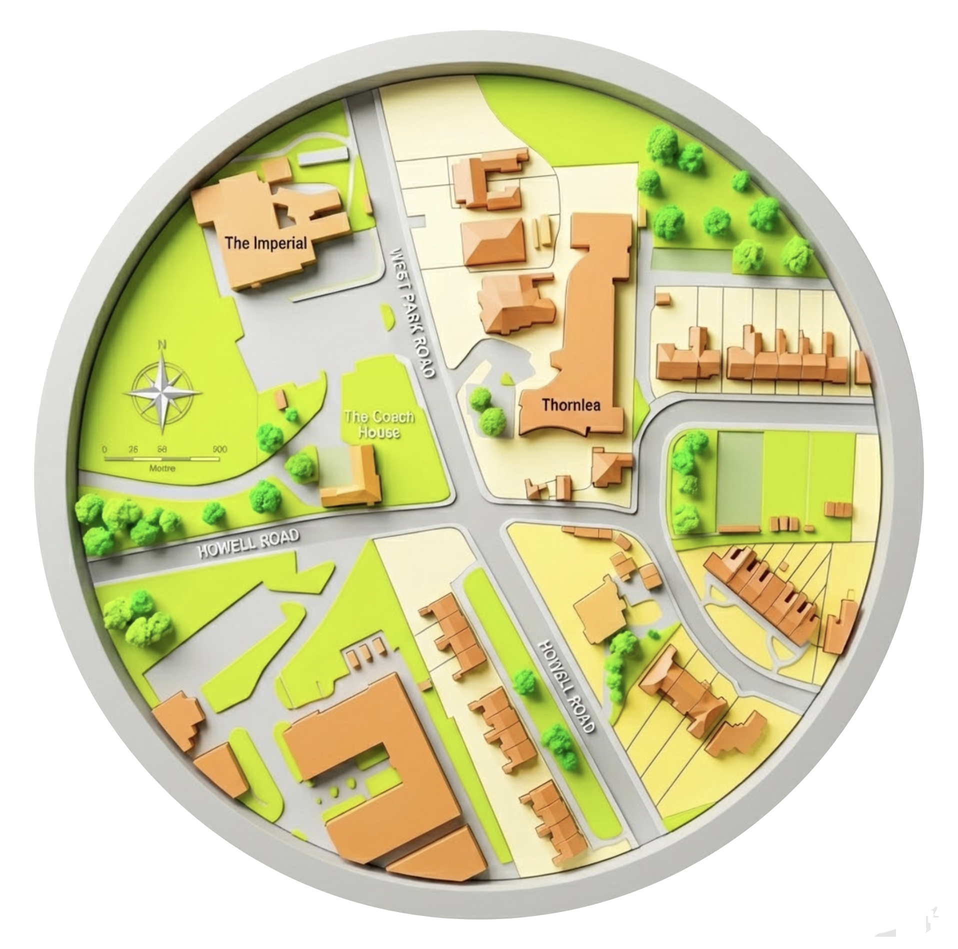
We provide OS planning maps for architects, engineers, surveyors and more for plannig permission in the UK. Planning applications require OS licensed data for site and location plans.
Our digital easy to use tool allows easy geospatial mapping tools.

SkyeBrowse is a software platform that uses patented videogrammetry to turn continuous video from drones, phones and other cameras into accurate 3D models and 2D maps. Cloud processing finishes in minutes, so crews skip the thousands of overlapping photos and the hours of processing that traditional photogrammetry needs.
SkyeBrowse is used by over 1,200 agencies worldwide, primarily public safety (crash and crime scene documentation), and also in construction and insurance. Capture with the SkyeBrowse Flight App, which automates flight on supported DJI and Autel drones, or upload nearly any MP4 or MOV video with Universal Upload. Models open in the browser with measurement, annotation and sharing tools. Paid tiers add exports (LAZ, GLB, OBJ, USDZ, GeoTIFF), AI Floor Plan and AI Site Plan, Line of Sight, Sun and Shadow and topographic maps, with CJIS compliance and chain of custody on Public Safety & Enterprise.